


ARGYLE - T 1 Voting District, Lafayette County, Wisconsin
About
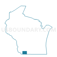
Outline

Summary
| Unique Area Identifier | 694550 |
| Name | ARGYLE - T 1 Voting District |
| County | Lafayette County |
| State | Wisconsin |
| Area (square miles) | 15.86 |
| Land Area (square miles) | 15.85 |
| Water Area (square miles) | 0.02 |
| % of Land Area | 99.89 |
| % of Water Area | 0.11 |
| Latitude of the Internal Point | 42.73709310 |
| Longtitude of the Internal Point | -89.88786320 |
Maps


Graphs
Select a template below for downloading or customizing gragh for ARGYLE - T 1 Voting District, Lafayette County, Wisconsin


Neighbors
Neighoring Voting District (by Name) Neighboring Voting District on the Map
- ADAMS - T 1 Voting District, Green County, WI
- ARGYLE - T 2 Voting District, Lafayette County, WI
- Argyle - V 1 Voting District, Lafayette County, WI
- BLANCHARD - T 1 Voting District, Lafayette County, WI
- FAYETTE - T 1 Voting District, Lafayette County, WI
- YORK - T 1 Voting District, Green County, WI
Top 10 Neighboring County Subdivision (by Population) Neighboring County Subdivision on the Map
- York town, Green County, WI (910)
- Argyle village, Lafayette County, WI (857)
- Adams town, Green County, WI (530)
- Argyle town, Lafayette County, WI (436)
- Fayette town, Lafayette County, WI (376)
- Blanchard town, Lafayette County, WI (264)
Top 10 Neighboring Place (by Population) Neighboring Place on the Map
Top 10 Neighboring Unified School District (by Population) Neighboring Unified School District on the Map
- Darlington Community School District, WI (4,917)
- Pecatonica Area School District, WI (2,745)
- Argyle School District, WI (1,972)